Monday, July 31, 2006

Riverside, WA

Riverside was on the way to Omak. This "bicycle wall" was near a small store in town.


The picture below was taken inside the store. This was the most disturbing sight of the trip.

Different Planet

Republic to Omak WA


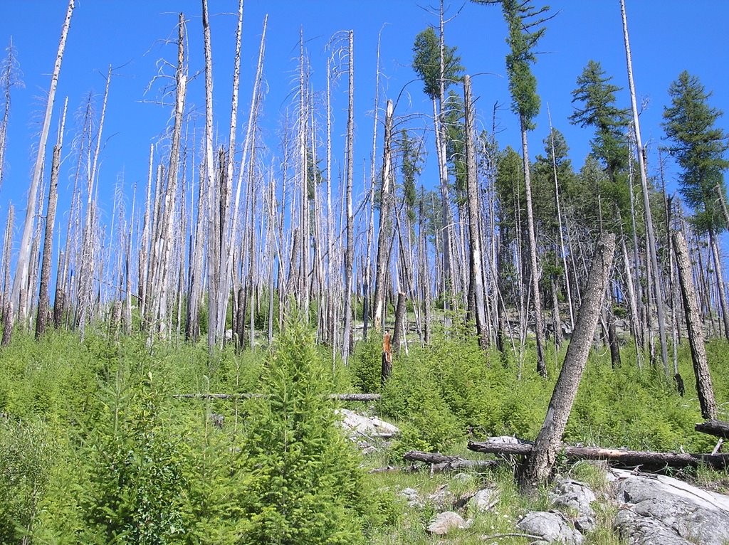
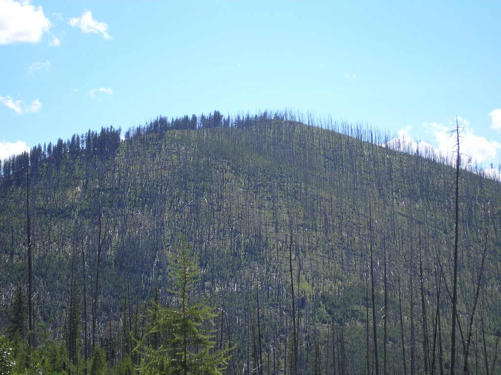
This entry is difficult to convey in pictures and words. The "different planet" title of this entry refers to the extreme landscape change from the "tough pass" day to the following day which these pictures were taken from.

The town of Republic is about halfway up Wauconda Pass. This pass was an easy climb. The scenery is very similar to the landscape experienced on Sherman Pass. About 2 miles into the downhill portion of Wauconda Pass I noticed the landscape and terrain changing. The land became very arid with very few trees. In a matter of 10 miles I felt like I was on a different planet. It was difficult to imagine that the day before I was in a thick green forest.

I ended this day in Omak WA. In Omak I ate dinner at a great restaurant called The Bread Line. If Italian food is your liking...The Bread Line will not disappoint.

Burn

On the way down from Sherman Pass the sign below was posted. The views were fascinating, but at the same time very eerie. Nearly 20 years have past and the forest is still recuperating.


I ended this day in Republic WA.

Tough Pass

Views from Sherman Pass.


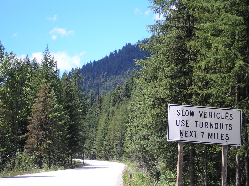
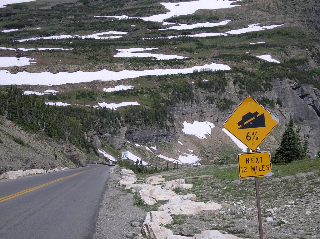
After crossing the Columbia River I tackled Sherman Pass. The climb was 22 miles and turned out to be the toughest climb of the 6 passes on my route. The temperature was hot without a cloud in the sky. I peddled the first 3 miles without stopping. I was spent. From there I peddled anywhere from one-half mile to a mile and then rested 5-10 minutes.

Somewhere in the middle of the climb I became so tired and forgot how many miles I had peddled on the climb so I started to keep track from that point. I had also lost track of where I was at on the map.

I'd peddled 8 miles from where I lost track of my mileage...The top of this monster had to be near. I was exhausted and had to stop. I placed my bicycle against a guard-rail and sat on the side of the road for nearly an hour. I ate a few snacks and played with my camera...Anything to get my mind off of the task at hand.

Once my heart rate became normal (I considered normal when I wasn't gasping for air) I started the climb again. As it turned out the peak was only 1 mile away. It was a tough mile. When I reached the top I felt the same as I did when I had to rest a mile back.

At the top there was a campground which consisted of a place to pitch a tent and a picnic table. There were no restrooms or water. Although there was a 15 mile downhill waiting for me I was too tired to continue. I was about to pitch my giant, 3 person tent but decided to wait. I laid on a picnic table for at least an hour. I may have fallen asleep. After resting I felt better and started the 15 mile downhill to Republic WA.

Friday, July 28, 2006

Columbia River


I crossed the Columbia River near Kettle Falls WA. At this point it was 1130AM and I had peddled about 55-60 miles for the day. On the other side of the Columbia River was the beginning of the climb to Sherman Pass. Because it was so early I decided to tackle the 22 mile climb.

Lake Pend Oreille


Lake Pend Oreille is another large lake. It took a little over 4 hours for me to peddle around it. The largest town of significance near the lake is Sandpoint ID.

I was in the state of Idaho for less than 24 hours.

Thursday, July 27, 2006

Lake Koocanusa


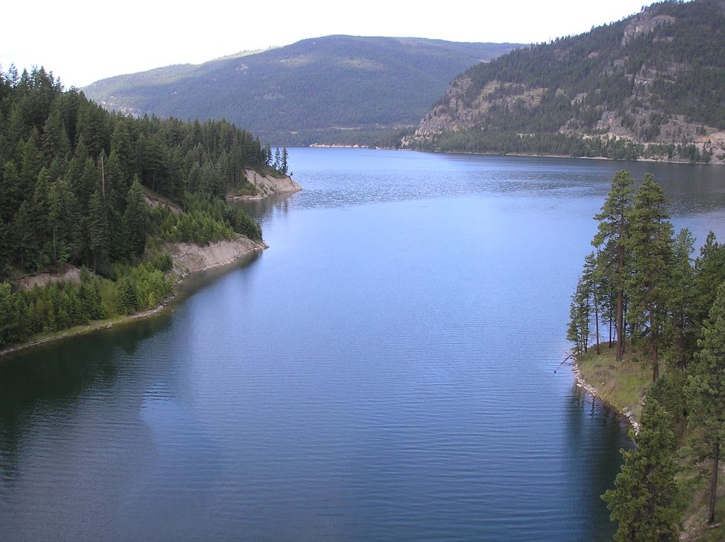
A few years back I visited the Lake Koocanusa area and was impressed with its clear water and impressive beauty. When I first purchased my bicycle maps and saw that I would be peddling along the lake for nearly 50 miles...I couldn't wait.

As I packed up camp in Eureka the sky was gloomy, I expected rain. As I approached the lake the sun started to break through the clouds. The lake was as beautiful as I remembered. Hwy 37, which wraps itself along the south side of the lake, rises and drops along bluffs and mountains. Countless views of the lake made the day a little longer than it should have been. If you are ever in the Glacier area...A drive up to Lake Koocanusa is worth the trip.

This ride took place on Tuesday July 11th. Along the lake I met 3 cyclists who left Anacortes on July 2nd. They were tired and unfit. If it took them 9 days to reach this point I knew I could be done with my trek in no more than 8 days. I reached the finish line the following Tuesday.

Eureka, MT


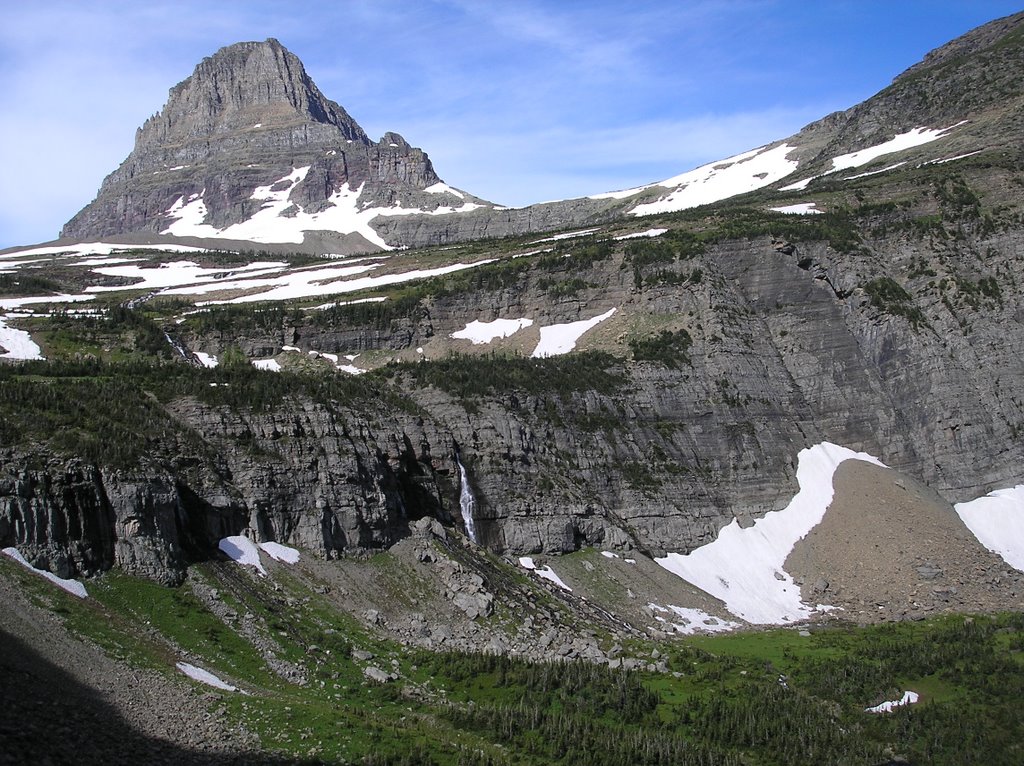
The day after leaving Glacier I continued my trek to Eureka MT, which is 7 miles from the Canadian border. On the way to Eureka I peddled through 30 minutes of rain. It was the last rain I would see on the trip. I would end my trek 7 days later. The rain stopped as I entered town. The above picture was taken before I set up my giant, heavy 3 person tent.

Going-to-the-Sun-Road: McDonald Creek


McDonald Creek empties into Lake McDonald. If you've ever wanted to try fly-fishing GNP is a great place start. When fishing inside the park you do not need a fishing license. A 10 day out of state fishing license in Montana is $80. In the park all you need is fly-fishing equipment.

Going-to-the-Sun-Road: Down Hill


Fast, fast, fast...The west side of the road is more more twists and switchbacks than the east side. I easily reached 40 mph several times. Unfortunately I had to stop several times because I had to use my breaks so often. My rims were burning hot to the touch. I was afraid that I would blow a tire. A blown tire at 40 mph plus would not be fun.

Third picture: Note the vehicles on the road across the valley.

Last picture: Weeping Wall

Going-to-the-Sun-Road: Logan Pass


It felt good to get the first of 6 passes complete. These pictures are views from Logan Pass.

The second picture: In a previous post I mentioned a mountain peak that was 25 miles away...this is the peak.

The bottom picture: Notice the ridge line across the mountain...that's the road.

Going-to-the-Sun-Road: Avalanche


Two weeks before arriving to GNP I met many cyclists heading east who said Going-to-the-Sun-Road was closed because of an avalanche. None of them knew on what side, east or west, of the road that the avalanche occurred.

I don't know when the road opened but it wasn't until the day before I arrived that I met a cyclist that said the road was open. One of the reasons that I chose the route that I did was because I've always wanted to ride my bike over Logan Pass. I was happy the road was opened before I arrived.

The top picture: Near the lower right of the picture there is a pine tree that points to the avalanche area as well as the road.

Second picture: Although traffic was allowed on the road, only one lane was open. A stop light was installed on each end of the avalanche area. The one lane access was half a mile long. I took the picture at the "end" of the green light so I had to wait for the next green light. During this time several cars were lining up behind me. When the light turned green I waved the vehicles behind to go around me. After the last vehicle passed I started the half mile portion knowing I better do it as fast as possible because there would be more vehicles coming up behind me as well as the vehicles waiting to come down were about to have a green light. The cars coming down must have gotten a green light when I was in the middle of the half mile portion.

The higher you get on the Going-to-the-Sun-Road the narrower the road gets. Under perfect conditions it is sometimes difficult to travel on the road when 2 cars met, let alone when you are on a bicycle and meeting on-coming traffic on a narrow one lane mountain road. The first few vehicles honked at me but I literally had no place to turn off. I was blessed with a diver of a truck who stopped his vehicle and got out. I thought he was going to give me a tongue lashing. I was wrong. He walked behind his vehicle and waved traffic to a stop. He knew the situation. As I passed him he said "Peddle as fast as you can...I don't know how long I can hold off these animals". I laughed and thanked him. As I passed the waiting vehicles many of the occupants were taking pictures of me. Maybe I will be part of their summer 2006 family vacation picture album.

The third picture is the area directly pass the stop light area.

Going-to-the-Sun-Road: Part 2


More pictures from the climb.

Going-To-the-Sun-Road


Going-to-the-Sun-Road is the main road that stretches through Glacier National Park. The road is over 50 miles long and includes some of the most beautiful scenery I've ever seen. Logan Pass is at the top of the road and was the highest in elevation of the 6 passes that I climbed.

First View of Saint Mary Lake


The top picture was taken about 6 miles from the east entrance of Glacier National Park (GNP). It was the first view of Saint Mary Lake, which is in GNP. The top picture...Near the middle and to the right of the picture there is a mountain peak. Just below the top of that peak is the Going-to-the-Sun-Road visitor center. I peddled up that road. From the point of that picture to that peak is roughly 25 miles.

The bottom picture was taken near the park's entrance.

Wednesday, July 26, 2006

Foothills of the Rockies


There was a steady climb as I approached Glacier National Park. Call them what you want but the foothills of the Rockies were just as bad as the Rockies themselves. I peddled up the road above.